Here are some possible ways to reconfigure Route 9 to make Broadway safe for everybody.
You can propose your own possibilities! Clicking on the diagrams takes you to Streetmix, where you can tweak things to your heart's content. (Just leave the overall right of way widths as they are.) If you come up with something great, email us the link.
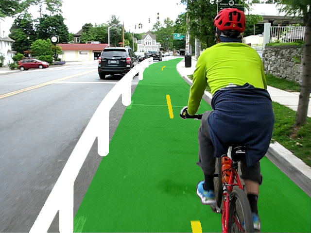
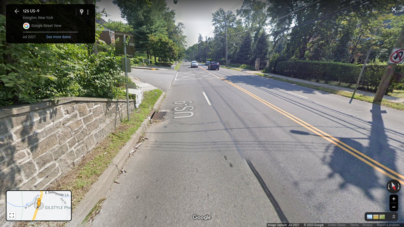
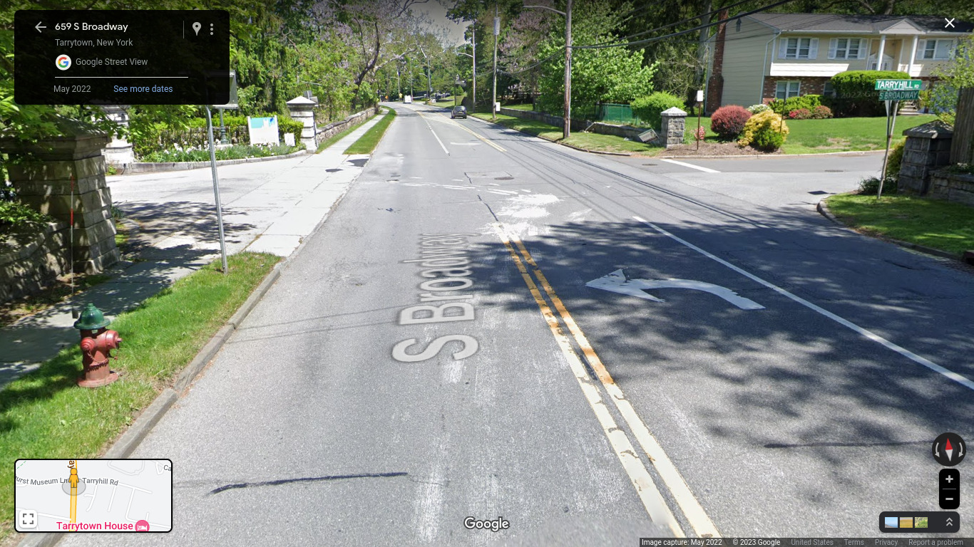
If you want to better understand what each location looks like, click on the relevant street view image.
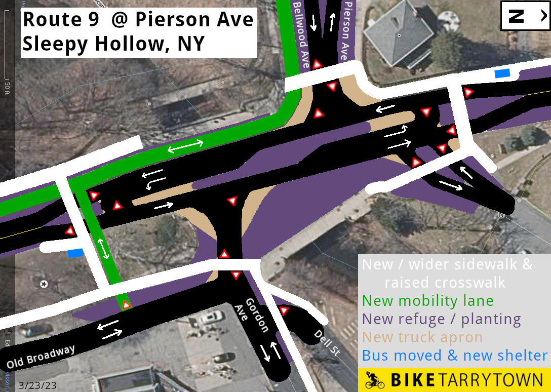
A "priority square" design at Pierson Ave can calm traffic, while keeping it flowing safely in all directions, while accommodating a protected two-way cycle lane on the west side of Broadway.
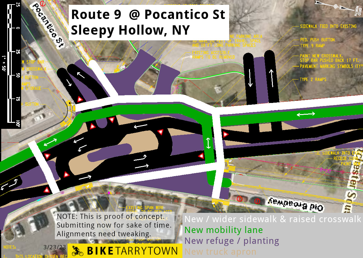
A similar "priority square" proposal for the Pocantico St intersection.
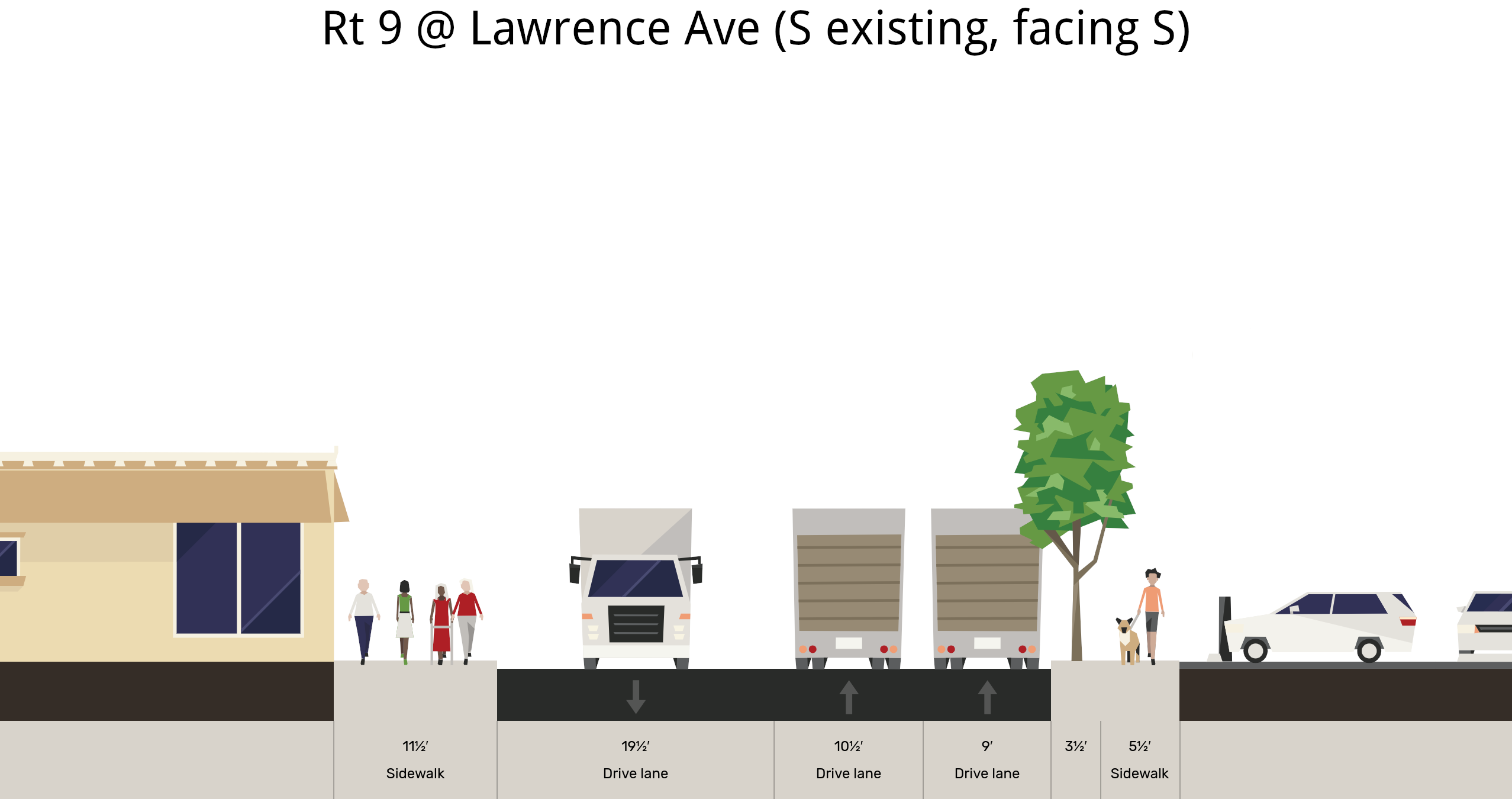
Existing layout of Broadway by Lawrence Ave, at the crosswalk between the Animal Hospital and the Gulf gas station.
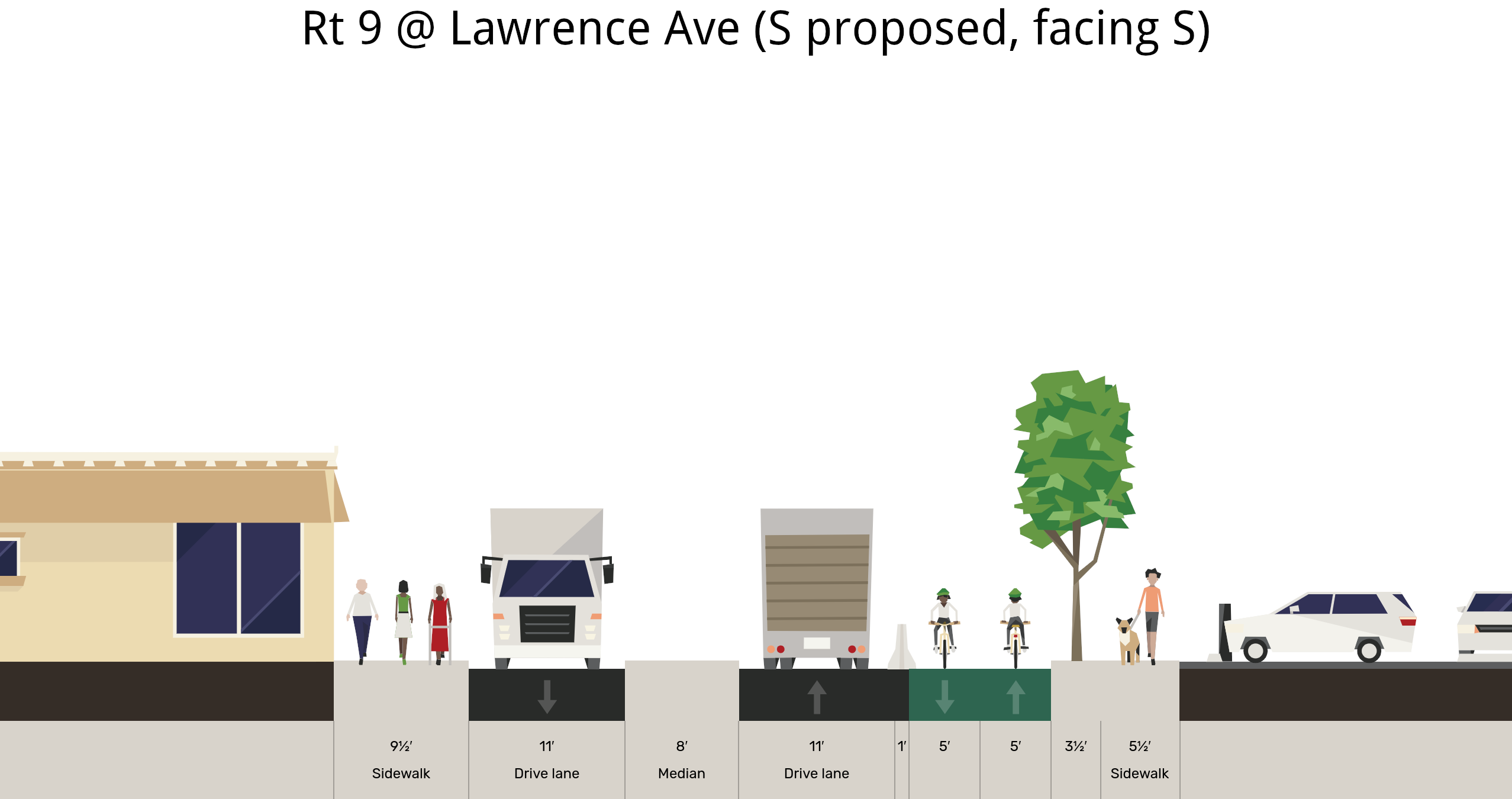
How to add a pedestrian refuge for the crosswalk between the Animal Hospital and the Gulf gas station, as well as a protected mobility lane in the area.
A 2-way, barrier protected cycle track can fit on the east side of Broadway by the High School / Middle School / John Paulding School campus.
Existing dimensions of Route 9 by the Korean Church
How to fit a protected mobility lane by the Korean Church. The sidewalk on the right should be 6' between trees and 5' when next to trees.
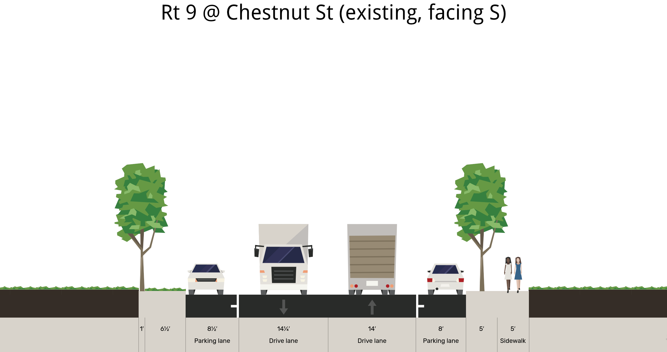
The existing configuration of Broadway at Chestnut St has very wide motor vehicle lanes.
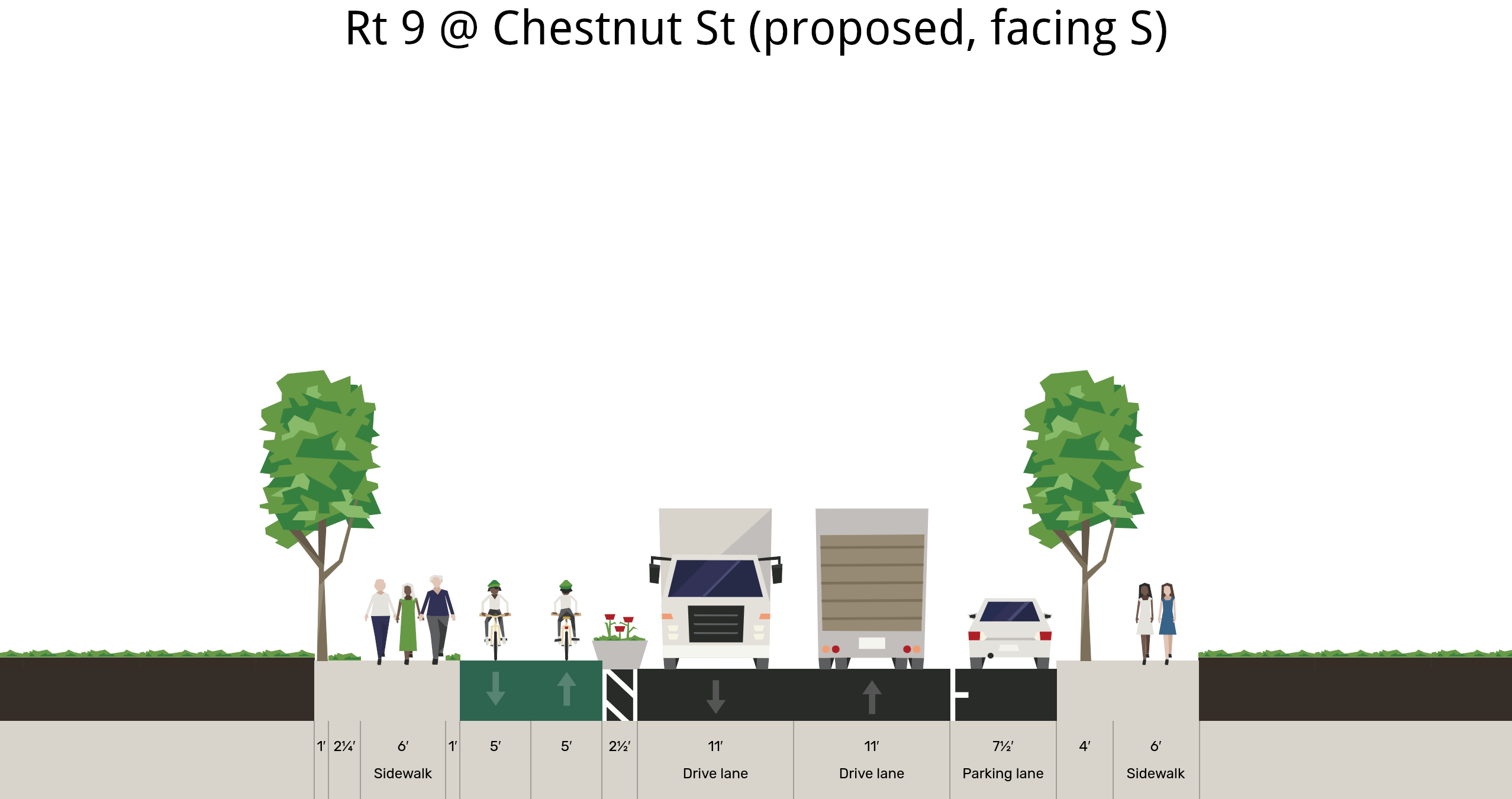
Making the motor vehicle lanes a safe width by Chestnut St frees up space for a protected mobility lane on the east side of Broadway. The sidewals should be 6' between trees and 5' when next to trees.
Existing cross section next to the 150 year old ginkgo tree at Immaculate Conception Church.
Shrinking the northbound motor vehicle lane, adding a barrier protected mobility lane along the east side, and installing a new sidewalk along the school wall provides a safe means of travel for all road users. The eastern sidewalk is wider to provide "shy distance" from both the wall and the edge of the mobility lane, while still providing some extra wiggle room for people walking during crowded times. It may also need to be elevated on fresh fill to protect the base of the existing stone wall.
These recommendations, and more, are in this presentation to the State Department of Transportation and their consultants.
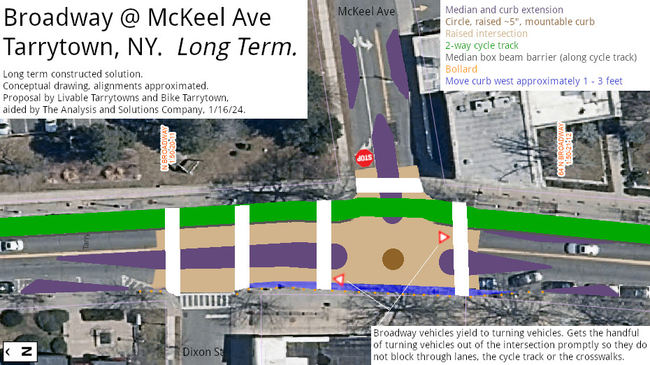
Creating a raised intersection at McKeel Ave and adding median refuges can make this periolous location safe and comfortable for everyone.
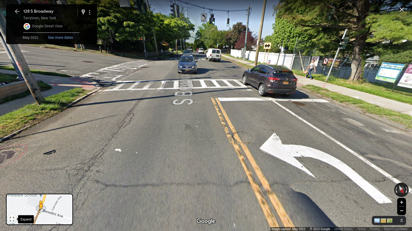
Not only is the intersection of South Broadway and Benedict Ave busy, it is overly wide and has turn signals in all three directions. The signal controller has fixed times for Broadway, leading to long wait times for people driving from Benedict Ave or walking across in any direction, even if no vehicles are present.
Installing splitter islands on Broadway and Benedict will keep people from speeding, allow elimination of signals, create a turn pocket and set up safe spaces to wait while walking across the street.
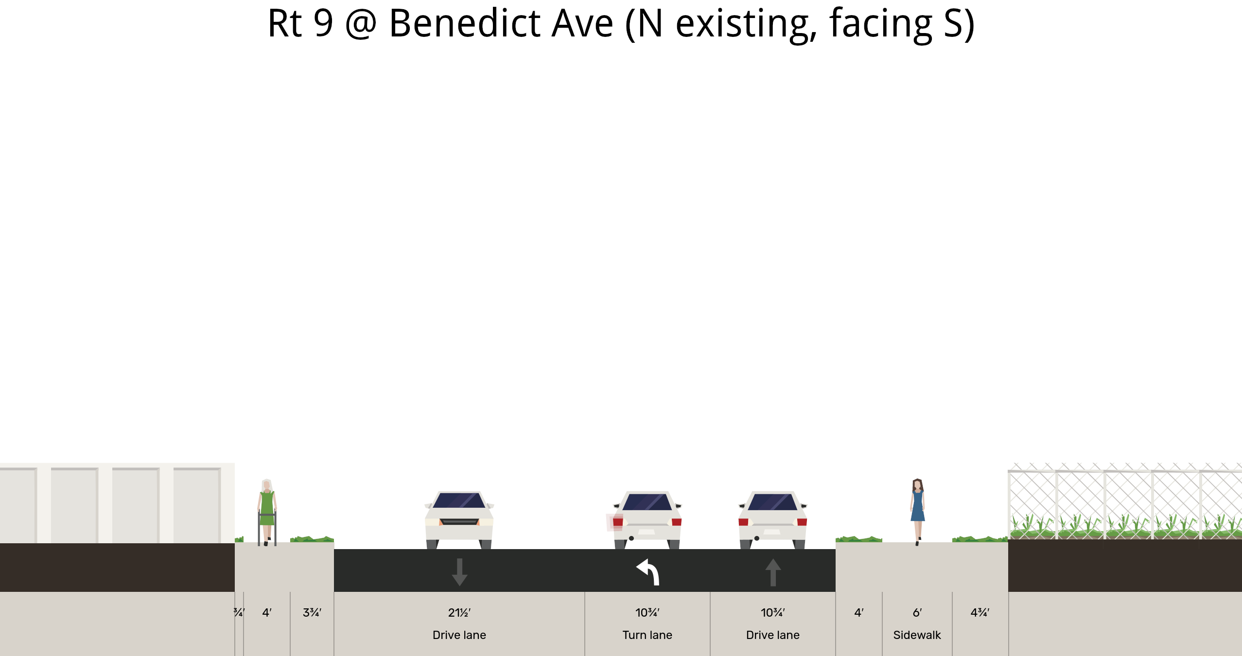
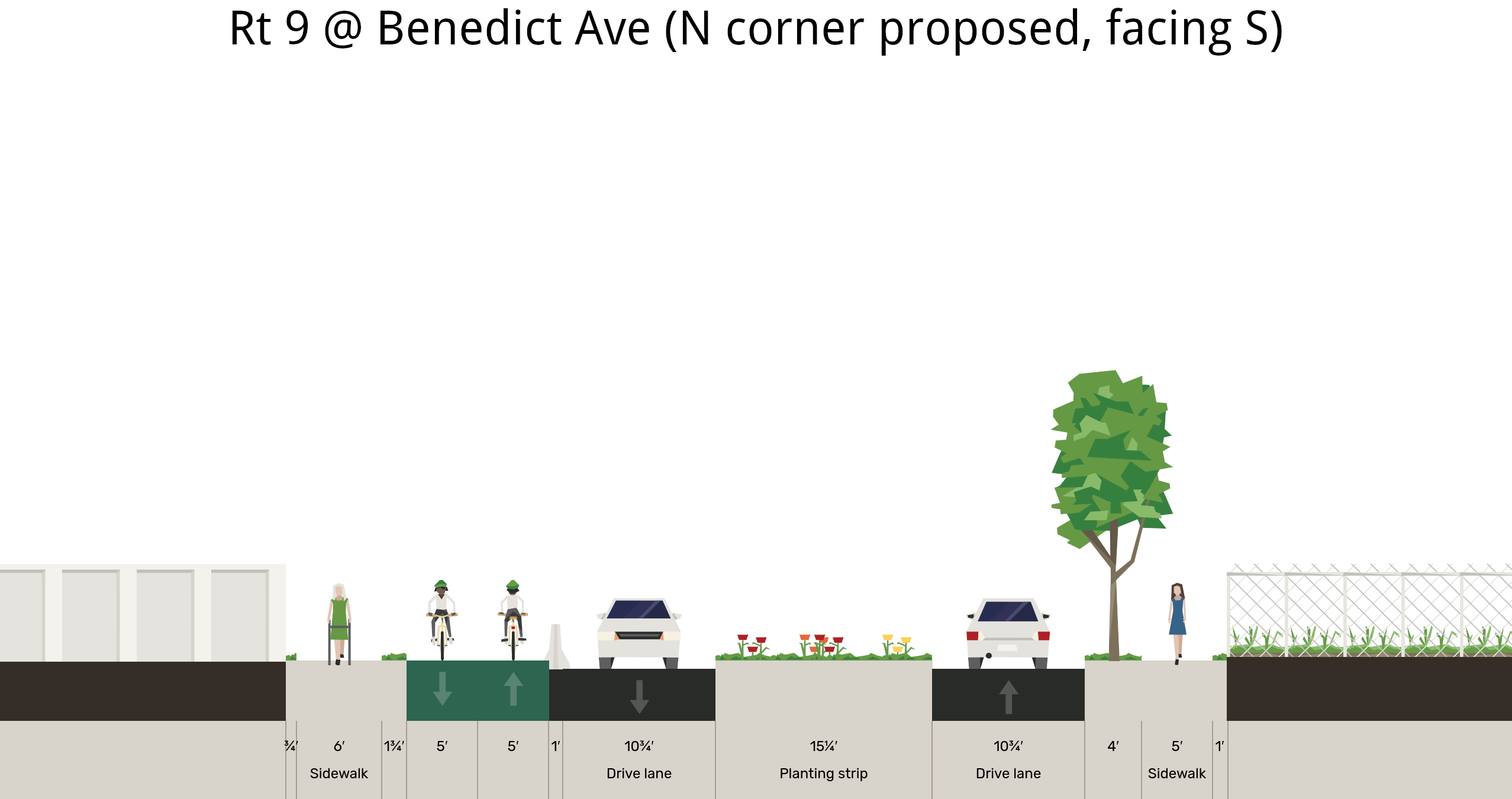
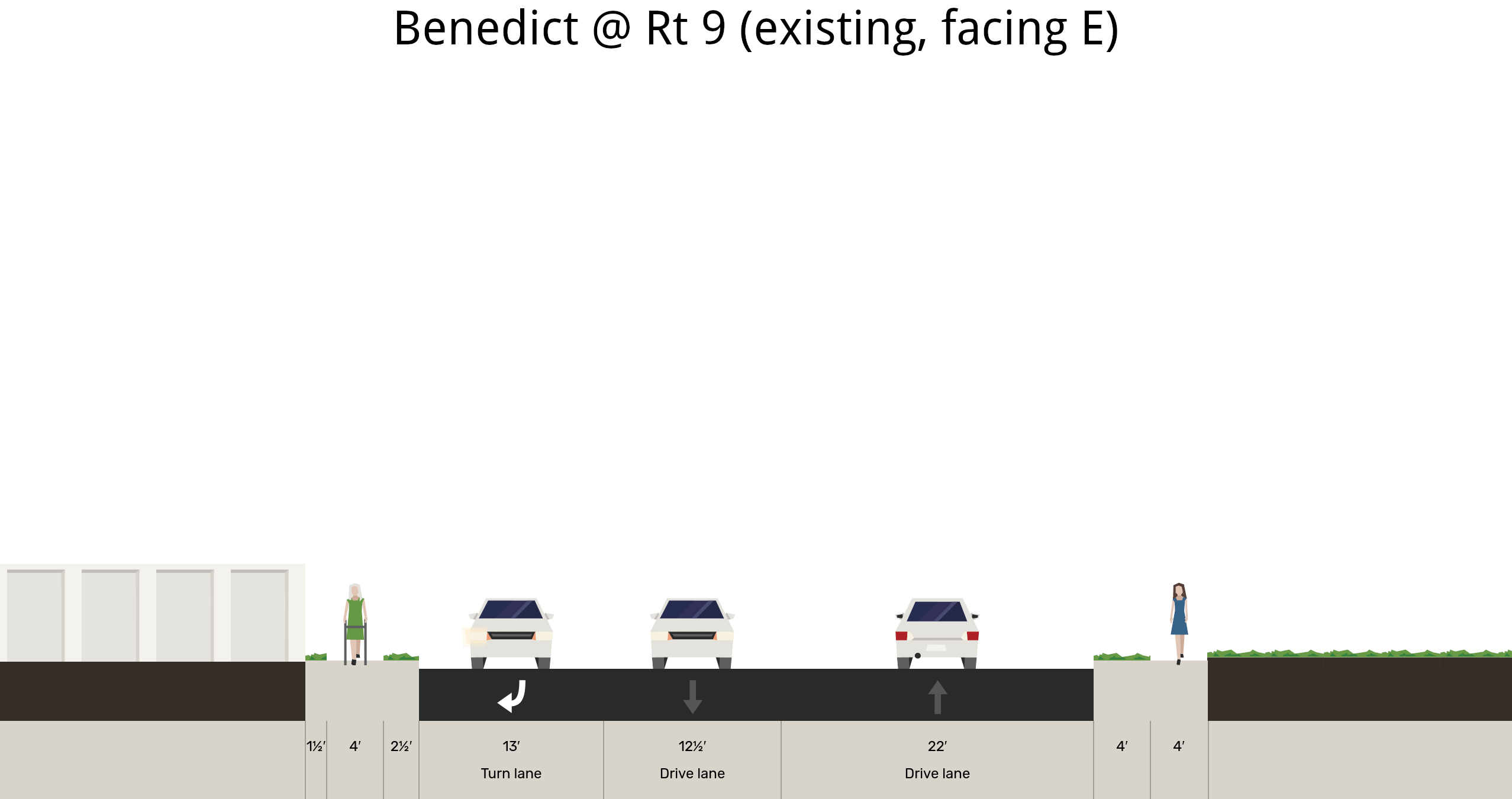
Existing dimensions of Route 9 on the north side of the intersection with Benedict Ave.
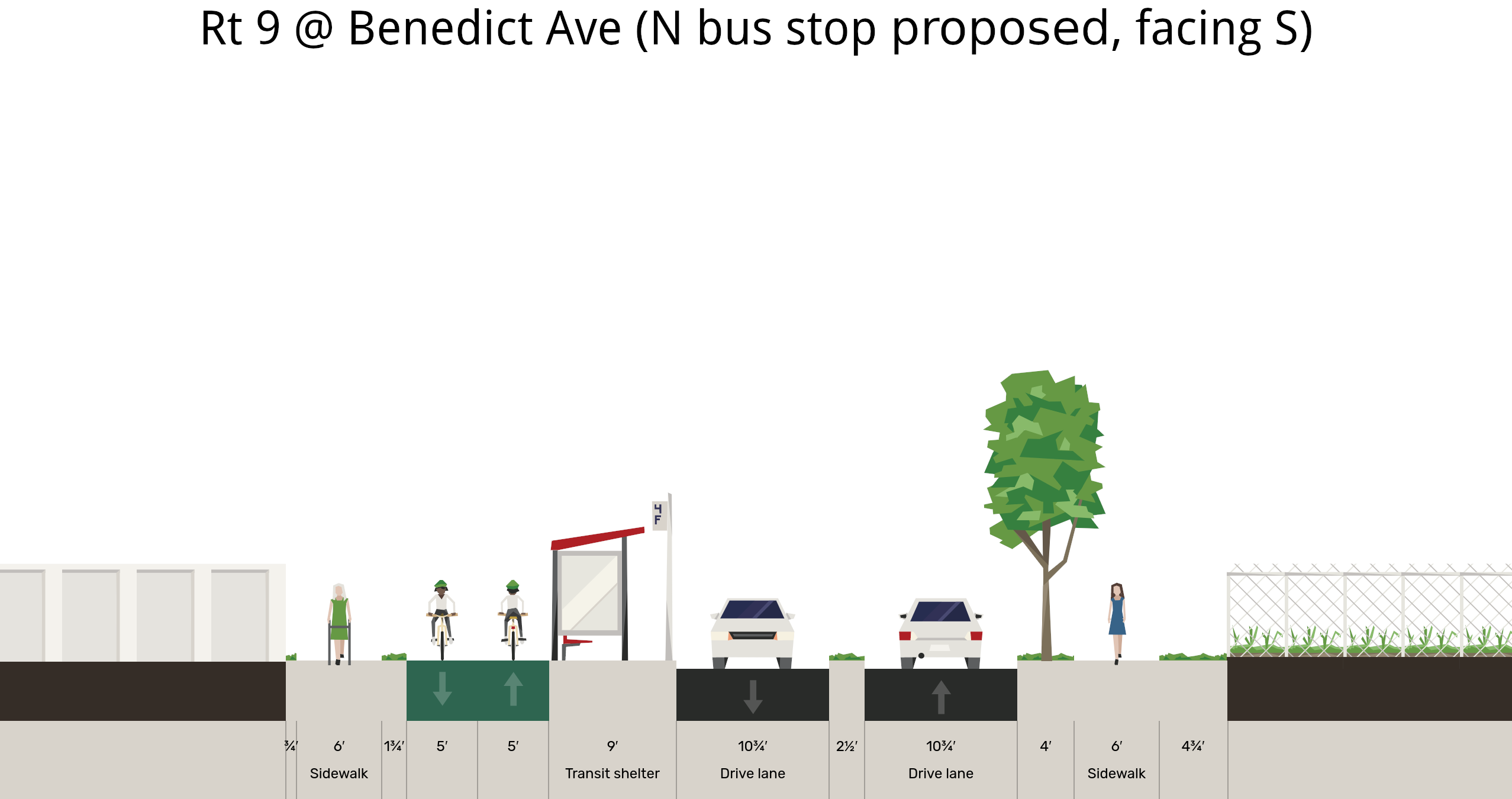
How a bus stop shelter can fit and calm traffic on Broadway a bit north of Benedict Ave.
It is possible to put a 15.25' median island / pedestrian refuge in the middle of Broadway on the north side of Benedict Ave.
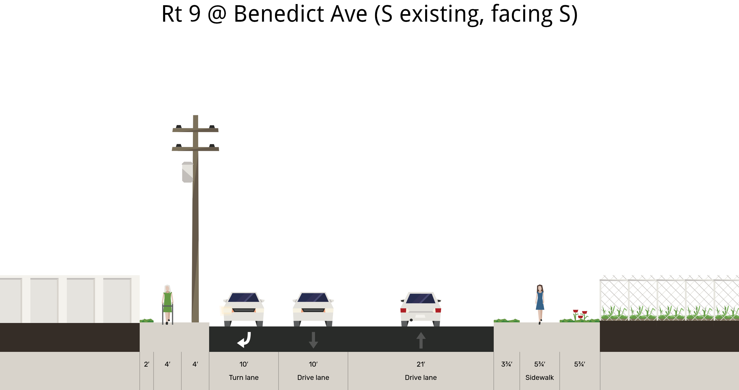
Existing dimensions of Route 9 on the south side of Benedict Ave.
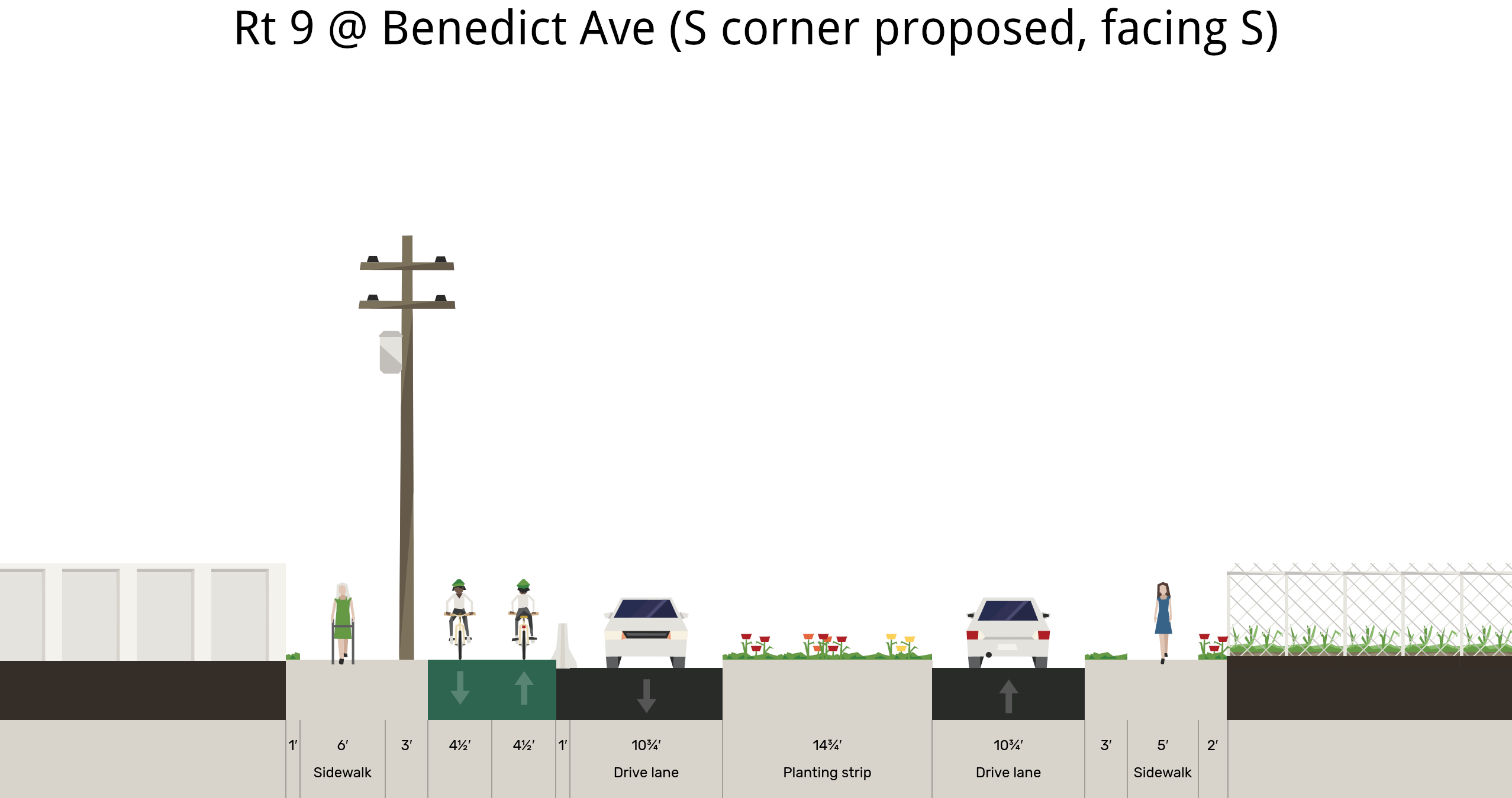
We can have a 14.75' refuge island on Broadway just south of Benedict Ave.
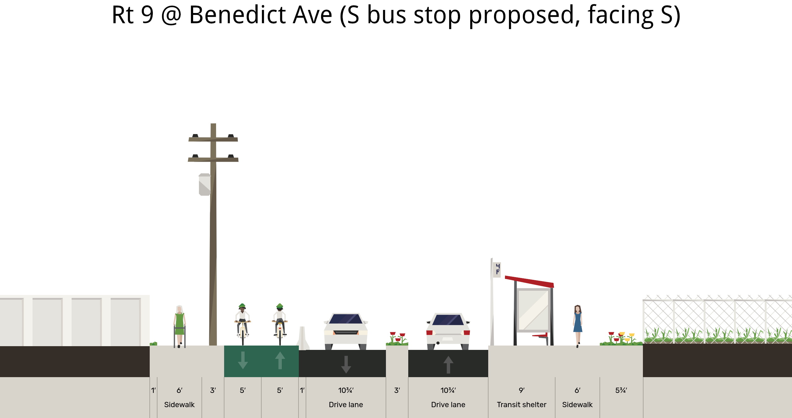
Where a bus stop shelter can go on Broadway a bit south of Benedict Ave.
Existing layout of Benedict Ave on the east side of Route 9.
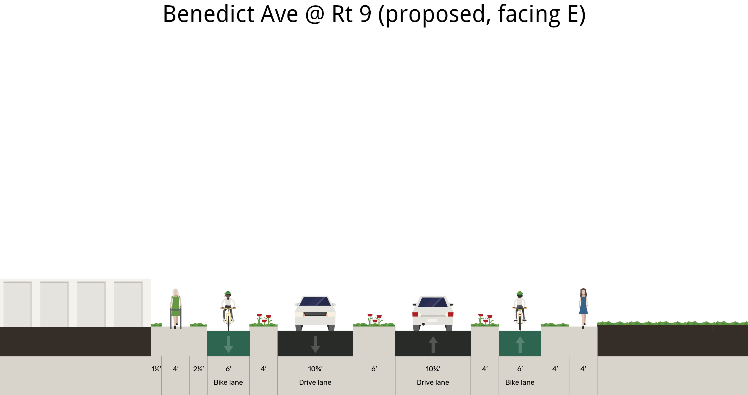
How to improve traffic flow and safety on Benedict Ave at Broadway.
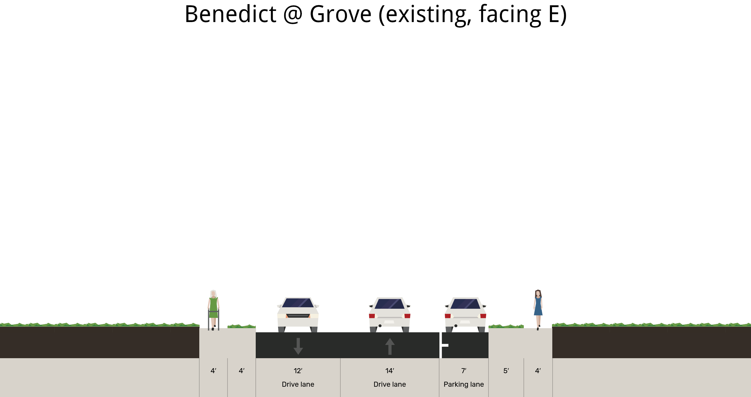
Present layout of Benedict Ave on the east side of Grove St.
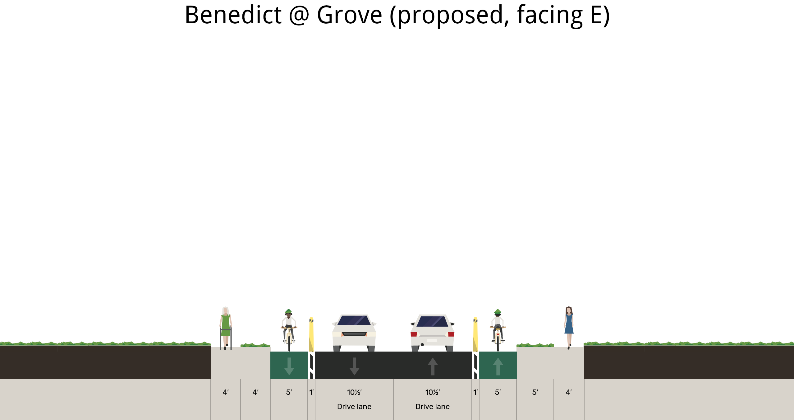
Proposal for Benedict Ave on the east side of Grove St. Showing this for context about the decisions made on the east side of Broadway.
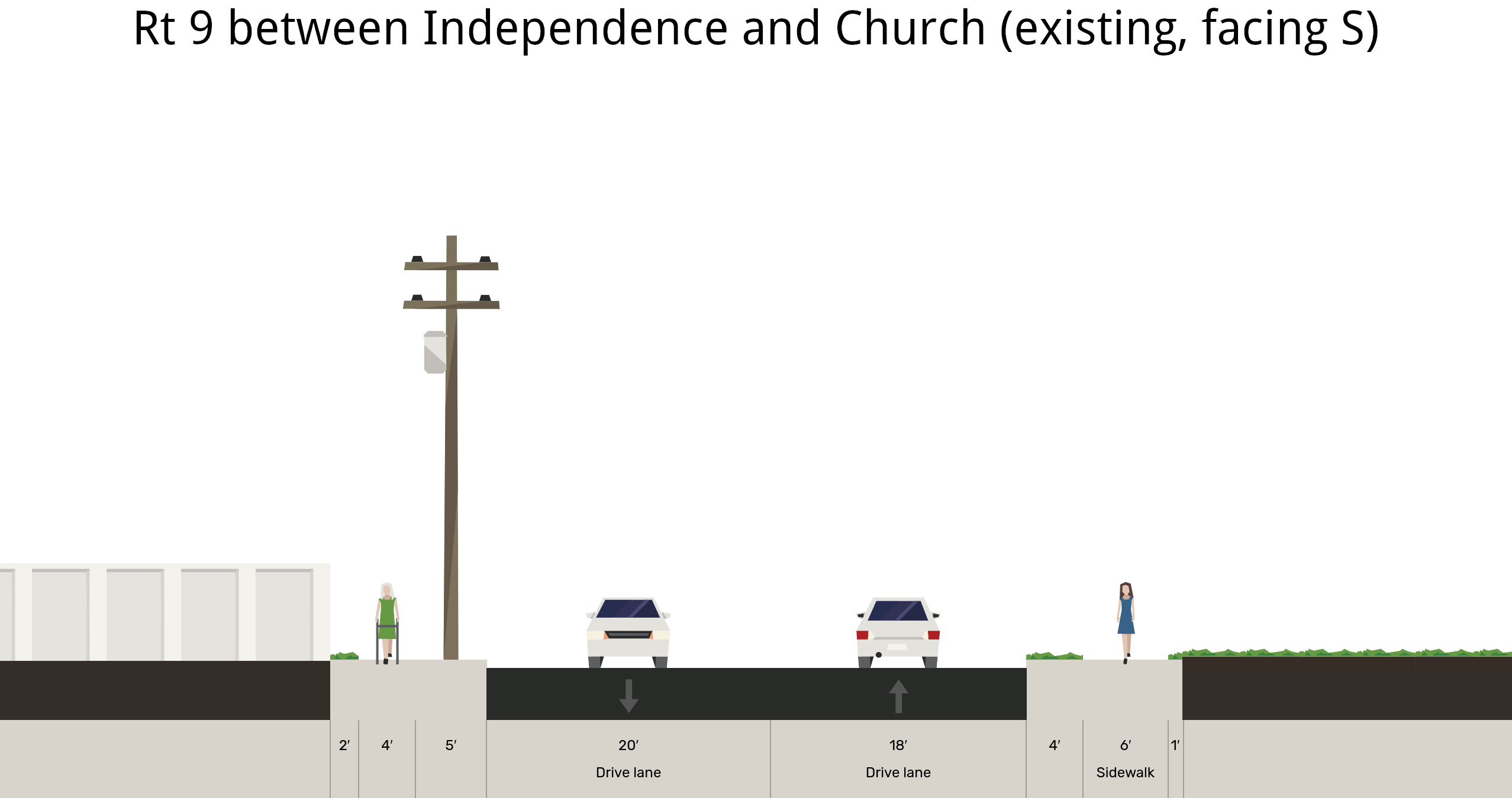
Current cross section of Route 9 between Independence St and Church St.
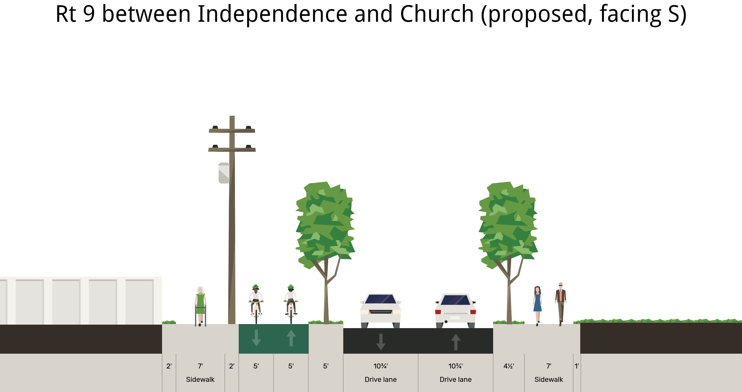
Broadway has room to be a glorious, tree lined boulevard with wide sidewalks and a protected mobility lane. Above is one potential way to make that happen.
We also crafted a presentation of recommendations to to NYSDOT and the consultants.
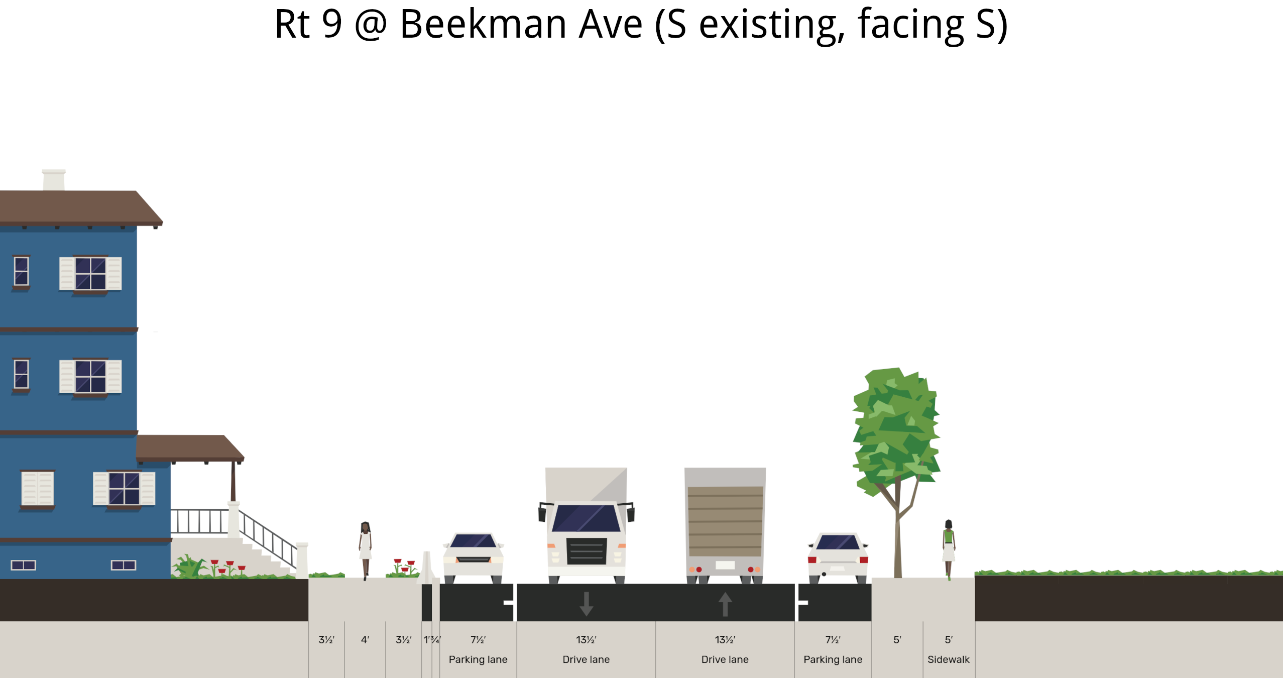
Most of Broadway in Irvington is like this. Long straightaways with 4 motor vehicle lanes. Sidewalk only on one side of the street. No crosswalks or turn lanes.
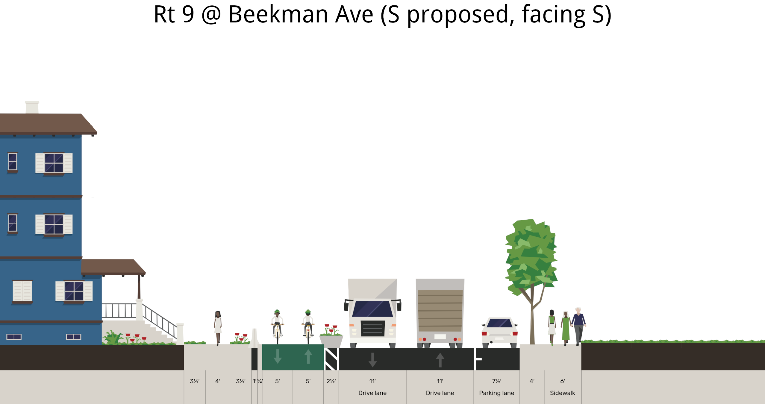
Here's a "4 to 3 conversion" that New York's Department of Transportation commonly does. This street view is from Route 9 at the entrance of Lyndhurst. While it's nice to have turn lanes, everything is still straight and wide, which welcomes fast driving.
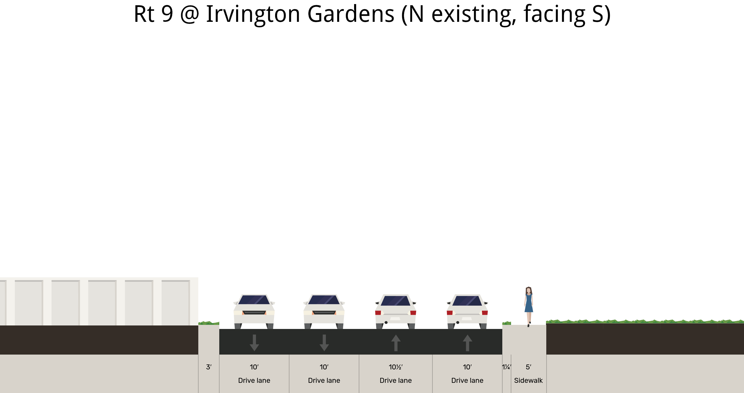
Existing widths of Route 9 just to the north of Irvington Gardens' driveway.
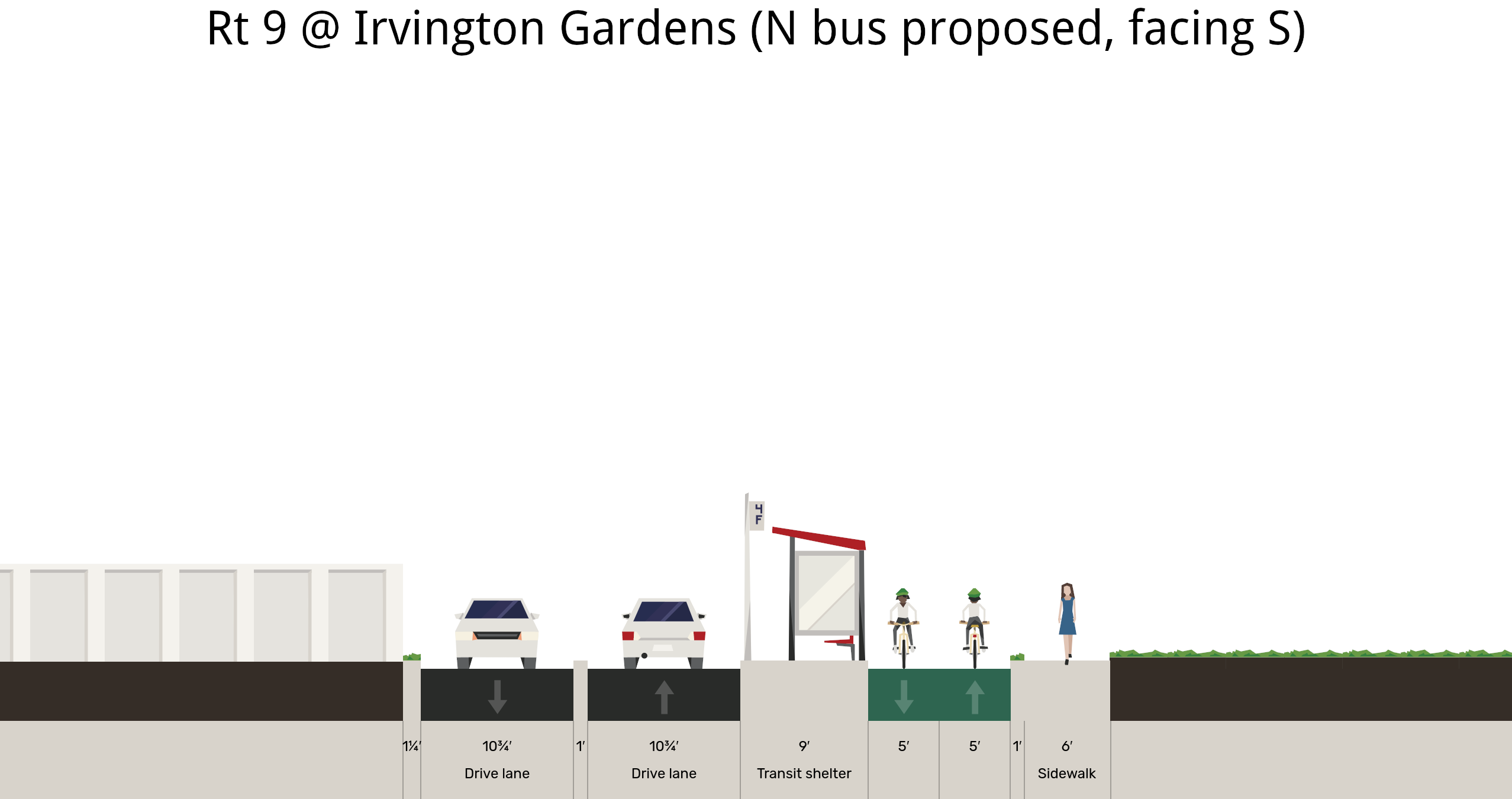
Proposal for how a southbound bus shelter and, better sidewalk and protected mobility lane can fit on Route 9 just north of Irvington Gardens.
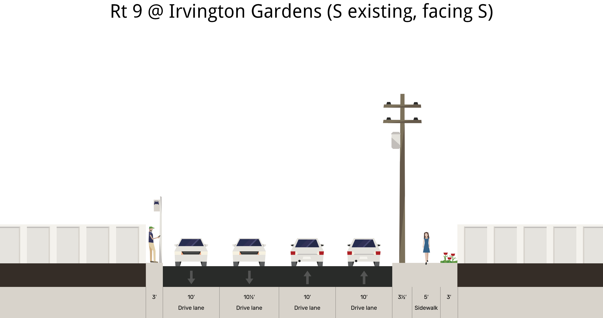
Broadway's right of way is a smidgen wider south of Irvington Gardens' driveway. Existing dimensions are shown, above.
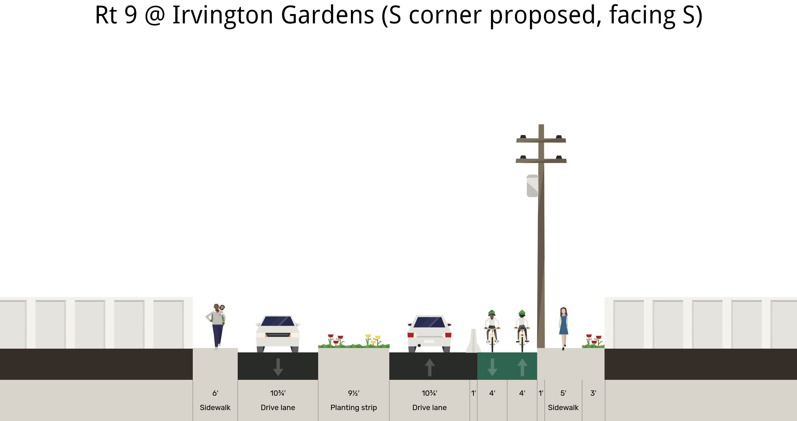
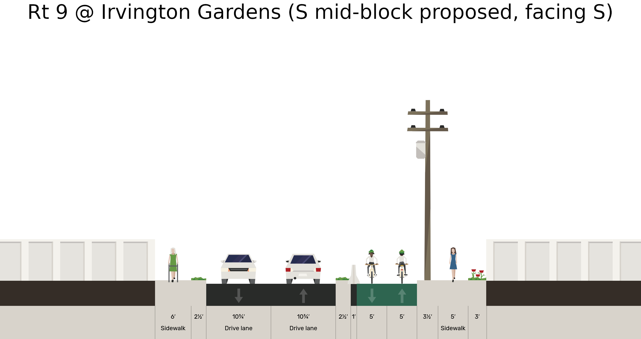
It is possible to put a median refuge / splitter island to create safe crossings and space for vehicles to turn in and out of Irvington Gardens' driveway. Room is also available for an eastern sidewalk and a two way protected mobility lane south of there. At this pinch point, the mobility lane is narrowed by two feet.
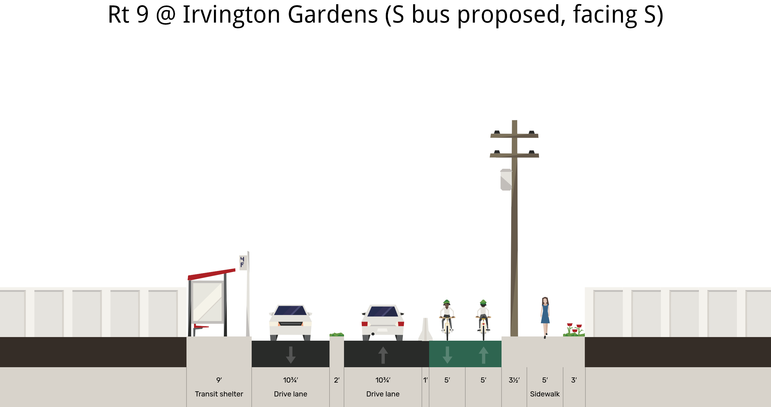
This concept shows a northbound bus shelter just south of Irvington Gardens, plus the aforementioned mobility lane, now with room for a proper width.
Between intersections, this proposal shows the driving lanes come together. This lateral shift helps keep people driving at safe speeds and makes space for a nicely sized sidewalk on the east side that is buffered from motor vehicles.
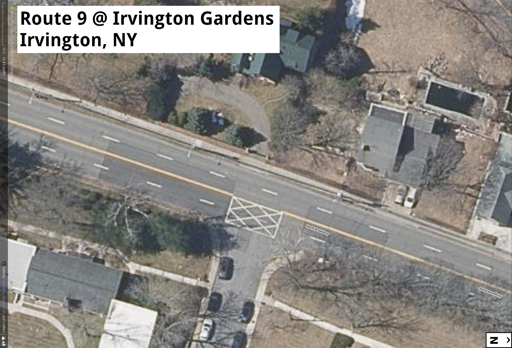
Aerial image of Route 9 around the Irvington Gardens driveway.
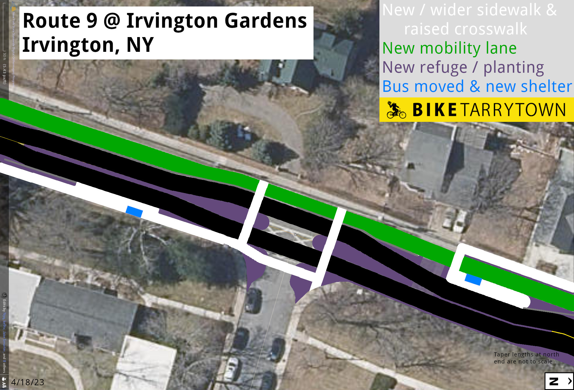
Here's how all of those cross section diagrams translate into a view from above. An area engineered to create safe spaces for all street users.
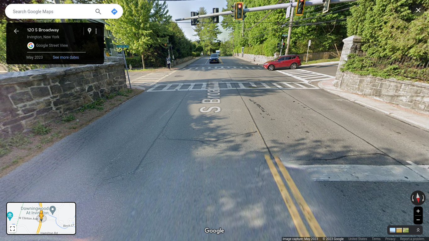
Broadway at Clinton Ave is a terrifying. The 2 foot 9 inch wide sidewalk is immediately adjacent to cars and trucks whizzing by.
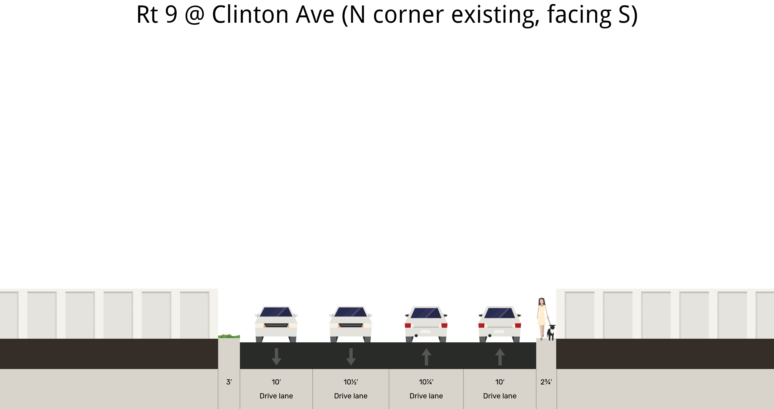
Cross section diagram of Broadway at Clinton Ave.
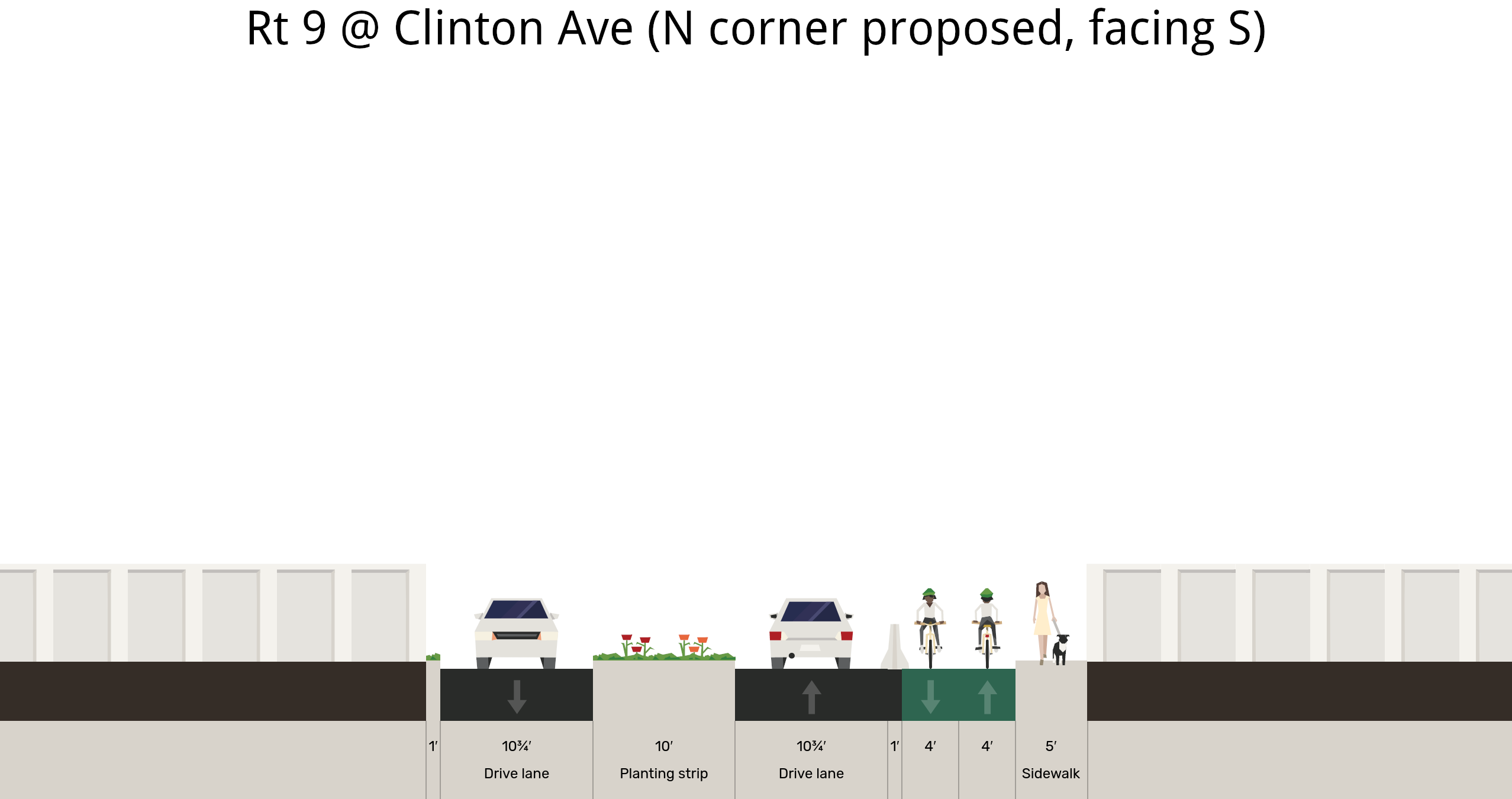
Changing Broadway at Clinton Ave to two motor vehicle lanes, with a median island for people walking or turning, makes room for a barrier protected mobility lane and a sidewalk that meets ADA minimums.
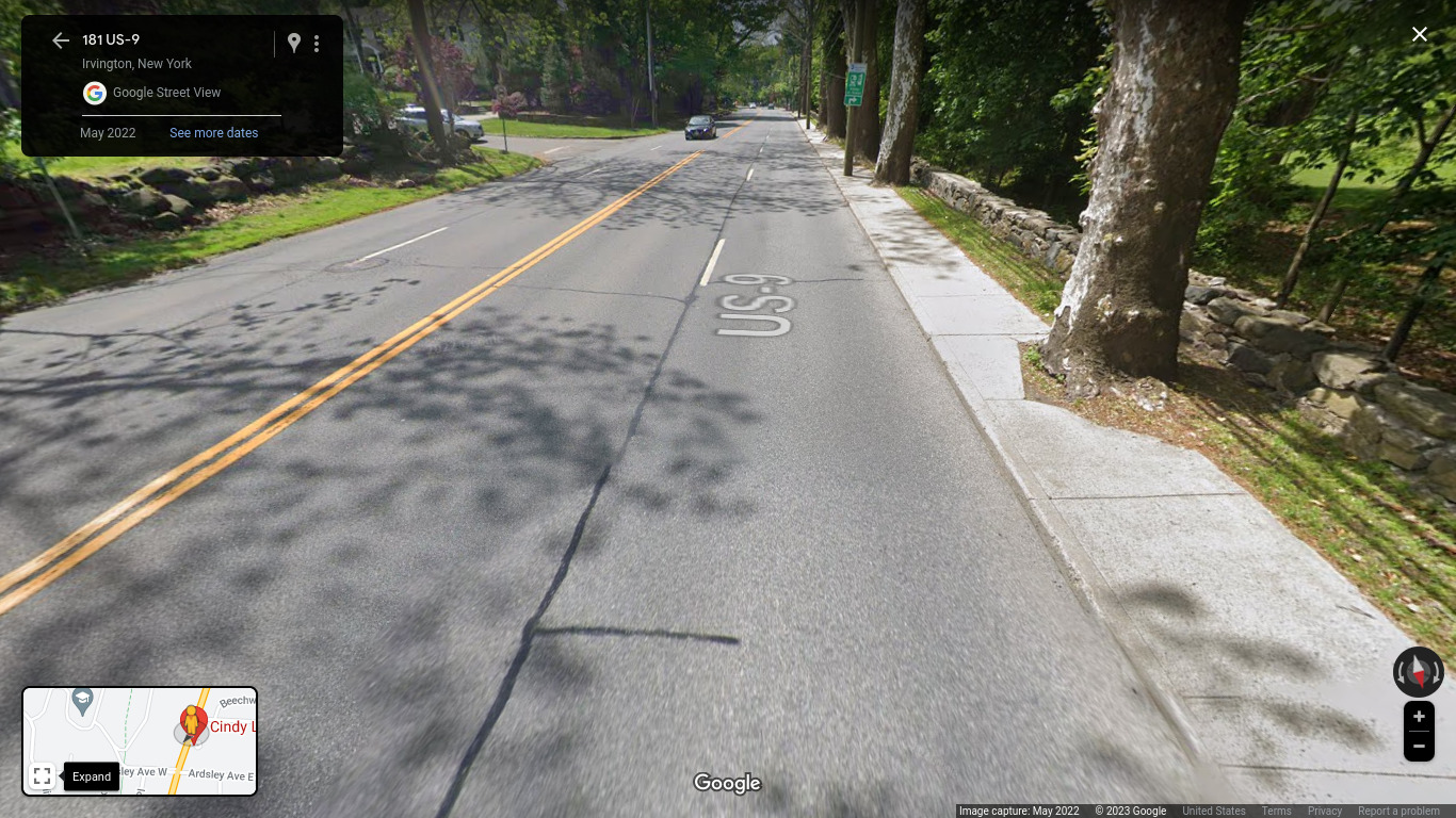
Route 9 along the Nevis Lab property has similar shortcomings. This stretch of sidewalk is a giant ADA Fail caused by trees, utility poles and fire hydrants, forcing people walking and rolling right up against moving motor vehicles. The road bed is straight as a rifle, encouraging people to drive like bullets. Residents on the east side of the road have no sidewalks or crosswalks on Broadway.
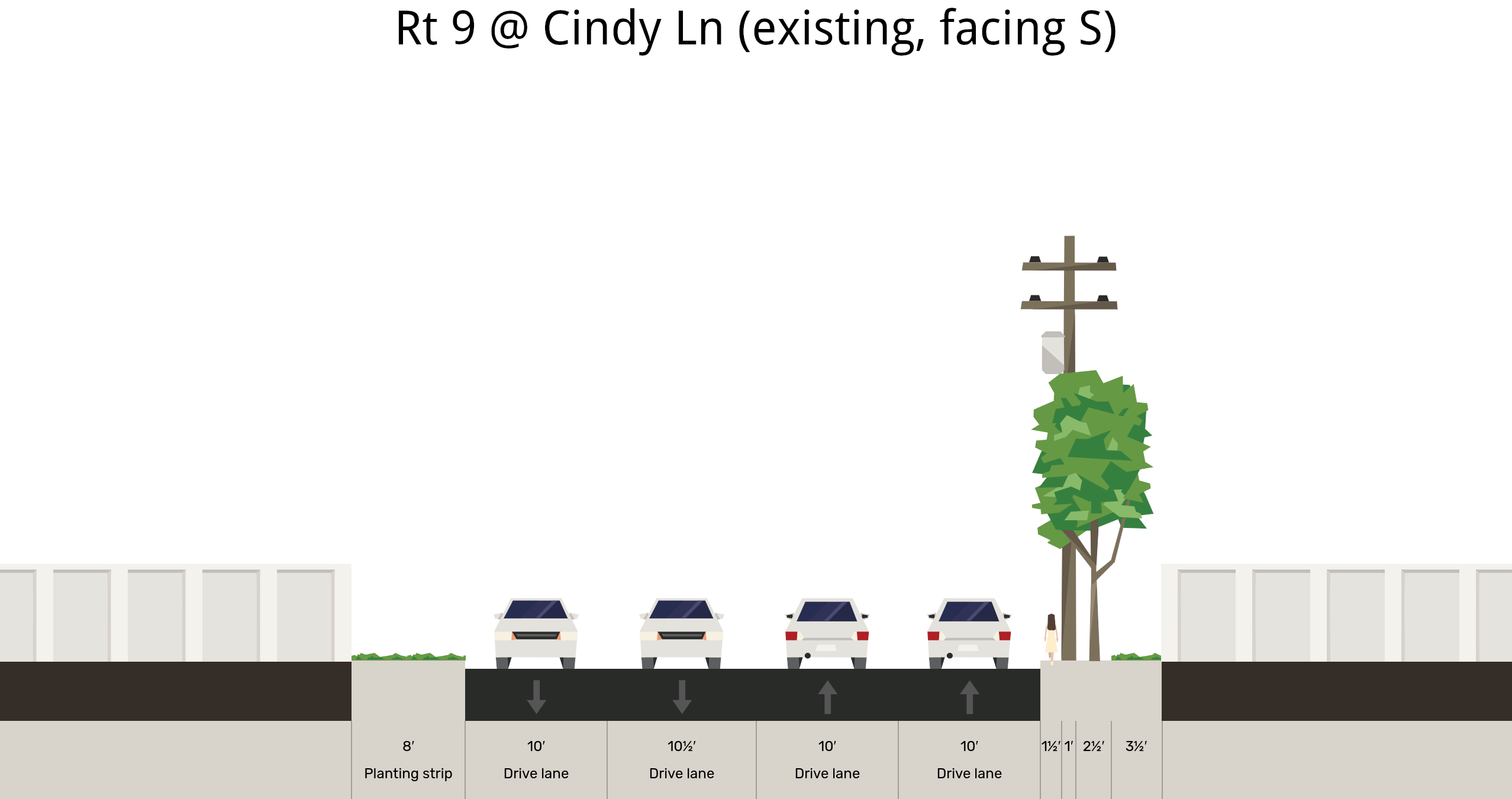
Above is a diagram of the existing conditions on Route 9 at Cindy Ln.
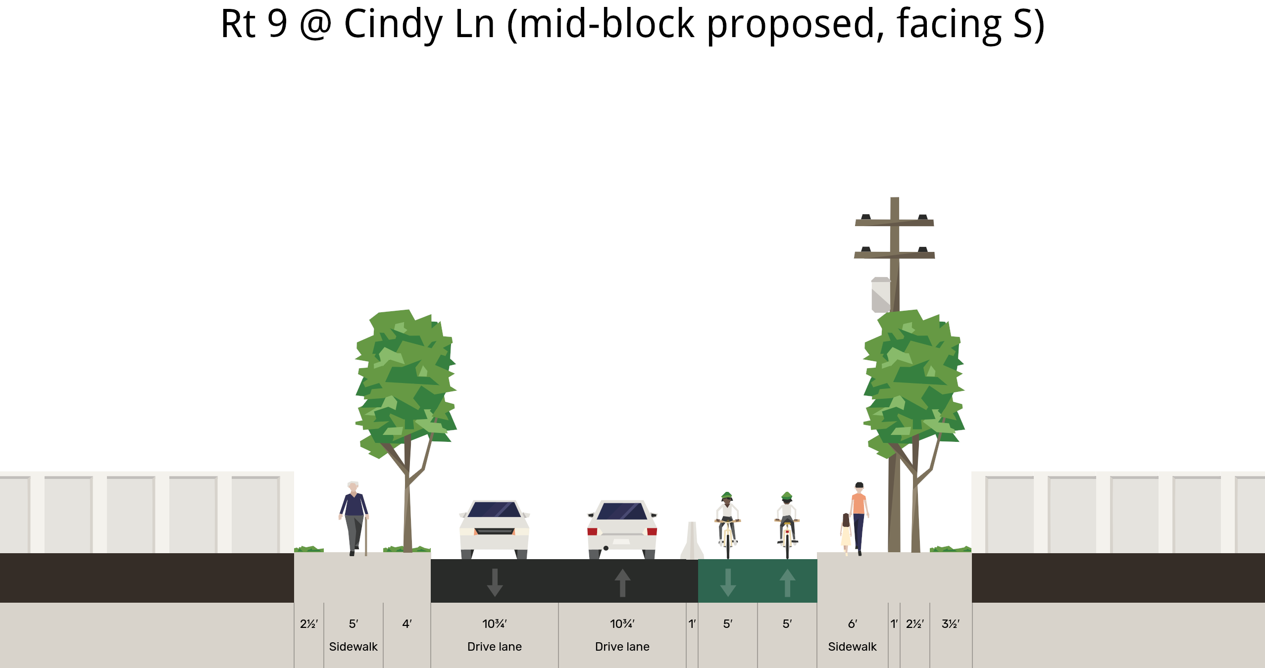
This suggestion shows the two motor vehicle lanes coming together, creating space for a nicely sized sidewalk on the east side buffered from motor vehicles by a row of new trees. The western sidewalk is widened and shielded from traffic by a barrier protected mobility lane.
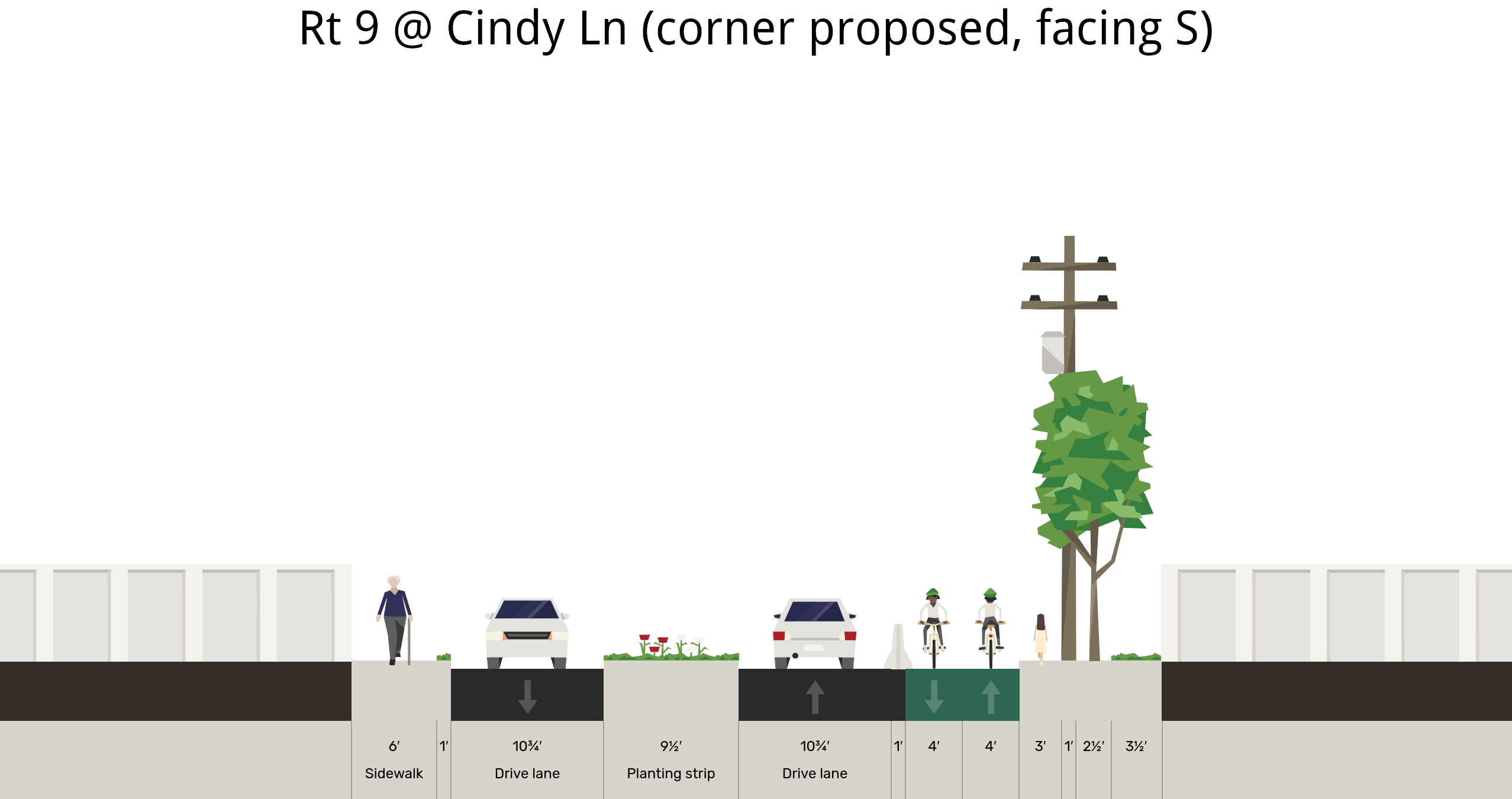
At the intersections, like Cindy Ln shown here, there can be splitter island refuges. As mentioned above, these shift the road bed laterally, making people drive more carefully and creating areas for people to walk safely across the street and for people turning into and out of the side streets.
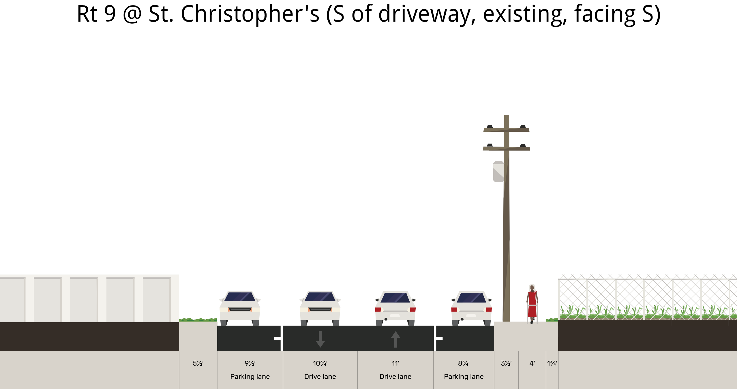
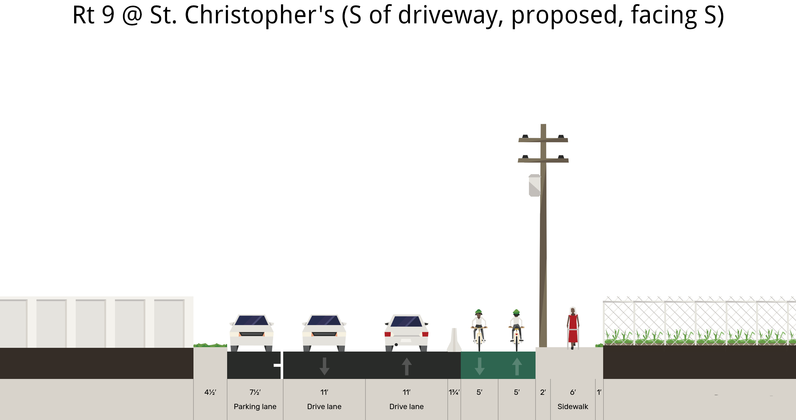
Present configuration of Broadway a few feet south of St. Christopher's driveway.
How to provide safe passage on Broadway for all street users south of Dobbs Ferry's Downtown.
biketarrytown.org | info@biketarrytown.org | B: @biketarrytown.bsky.social | F: @BikeTarrytn